|


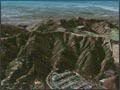
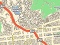
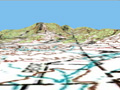
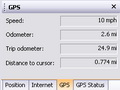
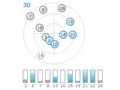
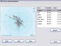
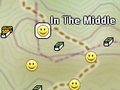
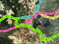
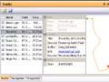
MapSphere Features OverviewWhat is MapSphere?MapSphere is a service for travelers and those who want to track travelers. MapSphere can download and display maps and satellite images. With a GPS receiver MapSphere can show your current position and record your track. GPS track, geotagged photos, chat notes, and blog posts form together a trip. MapSphere helps you to share your trip with others in a fast way and in almost automated mode. MapsMapSphere does not initially contain any maps. It is connected to different public sources of mapping data such as OpenStreetMap or Microsoft Research Maps. All the data is automatically downloaded and stored on a hard drive while you scroll or zoom the map. Once a map segment is downloaded, it becomes available in the offline mode too (without Internet connection). You can prepare maps beforehand and use them offline during a trip. The maps can be downloaded along any path or within a given radius. MapSphere supports 2D and 3D view modes. There are two additional views that can be customized to your needs and display your local and global positions at the same time. For example you can set a street map for the main view and satellite imagery for the detailed view. SearchMapSphere does not contain any built-in names database. It uses several public geocoding web-services instead. You can search for populated places and geographical objects all over the world in any language but streets and addresses are mainly represented in USA. A location can also be found by its coordinates. GPSMapSphere supports a wide range of GPS receivers via the NMEA protocol. You can see your current position on the map, speed, trip odometer, and GPS satellites status. The track is recorded automatically and can be saved as a GPX file. GeocachesGeocaching is a game where players around the world try to locate hidden containers, called geocaches, using GPS-enabled devices and then share their experiences online. MapSphere supports geocaches saved as a GPX file from Geocaching.com. You can open a single geocache file or a Pocket Query (the result of search containing a set of geocaches). You can see their location on the map and explore their attributes and description. This can help you in your quest. OnlineMapSphere Online consists of all functions available for the registered users while they are online. With MapSphere Online you can:
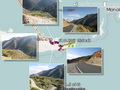
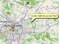
Creating an account is quick, free, and non-intrusive, so it is easy to join the MapSphere community. We recommend you to create an account right now. TrackingMapSphere provides several possibilities to track your friends (or members of the family, or a car). The person can use a laptop with MapSphere, the Glowfly application for Windows Mobile, or a GPS/GPRS tracker. Others can see his/her current position and GPS track on the map in their MapSphere applications. By default your position is visible to everybody. If you want to keep your privacy, you can limit your visibility to your contacts or a group of users. TripsPeople create a lot of multimedia data while travelling. MapSphere combines them together. It matches photos and chat notes with tracks and displays them on the map. You can view trips in the MapSphere application and on MapSphere Online site. For iPad owners we highly recommend MapSphere Trip & Photo Viewer application. It provides a comfortable way to view trip photos or show them to your friends. It is free and available on the App Store. |
|
||||||||||||||||||||||||||||


| Copyright © 2003-2026 MapSphere | Terms of Use Privacy Policy |