Be in touch while travelling!

  • navigate the whole world
  • take the maps to your trip
  • create your trip diary
  • save GPS track
  • watch the travels
  • communicate with others
  • perform GPS tracking
  • let others watch you

About MapSphere

MapSphere is a mapping software for Windows that:

  • downloads maps and satellite images from different sources
    (OpenStreetMap, Terraserver, LandSat, and others)
  • stores all the mapping data on the hard drive for offline use
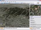
  • represents the map in 2D and 3D modes
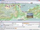
  • supports GPS-receivers to track your current position
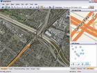
  • displays the location of other users and their GPS tracks
  • provides a chat to discuss your travels
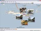
  • geo-references your photos according to your track
    and uploads them to your personal trip page
  • shows tracks, photos, and chat messages on the map
  • supports geocaching
  • supports an easy-to-use iPad viewer
  • supports GPS logger for iPad
Learn more...

Realistic 3D View

Fly over the Earth

Trips

Combine photos and track

Trips

Share your impressions

GPS Navigation

Save your track
Free download Get access to all
MapSphere features
Photos, blogs,
and other contents

Now on iPad!

Try MapSphere Trip & Photo Viewer, which gives the convenient access to MapSphere trip photos on your iPad.
New app MapSphere GPS Logger for recording GPS track.

GPS Track Editor

Try our brand new GPS Track Editor for Windows - a tool to view, analyze, and edit GPS tracks.

News

July 24, 2012

High resolution photos in MapSphere

High resolution images are now supported by MapSphere! »
June 09, 2012

MapSphere GPS Logger for iPad

Now you can record GPS track with your iPad and easily upload it to your trip. »
June 06, 2012

GPS Track Editor

We are pleased to announce our brand new application: GPS Track Editor. »
Copyright © 2003-2024 MapSphere Terms of Use      Privacy Policy